Choosing a Satellite Device: Garmin inReach vs. SPOT Gen3
I’ll start off by being very blunt – I used to own a SPOT device, but now own a DeLorme inReach. Yes, I’m biased, but I made the switch for a reason, and will do my best to detail the advantages of each.
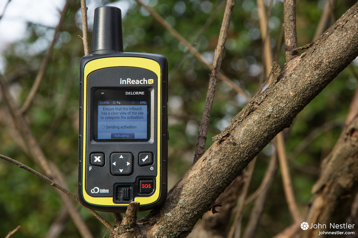
Note: In early 2016 Garmin purchased DeLorme. Since then the popular DeLorme inReach SE and inReach Explorer have been rebranded as the Garmin inReach SE+ and Garmin inReach Explorer+. I haven't been able to test these new devices, but would assume that the basic functionality remains the same (thus the title change). Hopefully in the future I'll be able to test them side by side to see how the devices differ.
I always choose to carry a satellite communicator on any big expedition, and it’s just as much for the peace of mind of my family as it is for my safety. Being gone for a month at a time in the backcountry can take a toll on parents or friends back home, wondering if everything is all right. Getting a little nightly message saying you’re fine does wonders to quell those fears. And of course, these devices could save your life if you’re severely hurt or stranded in the wilderness and need a rescue.
Note: Some links in this post are affiliate links. Basically, I get a small percent of the sale if something is bought through these links. This income helps pay for hosting, design, and content on the site. Please consider supporting this site and using these links if you decide to purchase a piece of gear. Additionally, I only write about gear that I use regularly & trust.
Value
Let’s first look at the financial side of things. Yes, you probably don’t want to skimp on safety gear, but you also don’t want to be spending money needlessly. Before you even look into the subscription plans, you’re going to need to purchase the device – here are the going rates on Amazon (July 2016):
SPOT Gen3: $149.95
DeLorme inReach SE: $263.95
You’re going to be spending double if you decide to purchase the DeLorme, but it may be worth it in the long run. Here’s where things get interesting with the subscription plans (click for larger images):


Basically you have no choice but to pony up for a full year of SPOT service, which is a minimum $149.99 charge. Don’t fall for the monthly payment trap since it locks you into a 12-month contract, where you’re essentially paying a higher monthly rate for the same one-year service plan.
DeLorme has a cool feature called the “Freedom Plan”. Basically you pay $24.95 per year to enable this, but can pick and choose your activation times (at $14.95/month). So you can activate for one month, not pay for the next, then activate it again if you want. Let’s say that you have two big trips this year (approximately two months) – the total yearly subscription cost for the DeLorme would be $54.85 ($24.95 + 2x$14.95)
The grand total for the SPOT and activation for a year is $286.98 ($136.99 + $149.99). Coverage with the DeLorme would be $318.85 ($264 + $54.85). In the short term the SPOT wins, but look at what happens to the total cost if you keep this type of usage up for two more years:
Year 2
SPOT: $436.97 ($286.98 + $149.99)
DeLorme $373.70 ($318.85 + $54.85)
Year 3
SPOT: $586.96 ($436.97 + $149.99)
DeLorme $428.55 ($373.70 + $54.85)
Based on this hypothetical usage, the DeLorme is much more cost effective after just two years of use. Extend that to three years and you’ve saved about $158 over the same service with a SPOT. You paid more for the upfront cost of buying the device, but the Freedom Plan pays off in flexibility and cost savings in the future.
Function
Aside from the financial side of things, a key difference exists in the functions of each device. Both will alert SAR to your location through GEOS International Response, but the SPOT can only send preset messages from the device, whereas the DeLorme enables two-way texting.
This function is crucial – typing out a message can enable you to give important information to the SAR agency, and family members can send a text to you if they want as well. Depending on your plan, these texts may be free, or could cost $0.50 apiece. This added functionality is a game changer though, and it adds to your peace of mind as well when you receive a message that all is good back home. Think about the DeLorme as a texting device with an international phone plan (but a lot cheaper).
If you’re looking for a small, compact device to track your location with, the SPOT may be a better choice. I primarily use the DeLorme to communicate text information, and less so to share my location. The functionality exists on the DeLorme, but the SPOT is better suited to frequent pings.
One big factor is the type of battery power each device uses. Both devices last quite a while with their batteries - the DeLorme only lost 15% battery on a 28-day trip of mine where 15 texts were sent, but the device was powered off when not in use. The SPOT has great battery life (mine went 70+ days of use with a nightly “OK“ message. The DeLorme uses a rechargeable battery core though, so a power source & charging cable need to be brought into the field, whereas you can easily replace the 4 AAA batteries used in a SPOT.
Coverage
The DeLorme uses the Iridium network, which is composed of 66 low-angle satellites, covers the entire Earth, and is pretty much the gold standard in satellite communications.
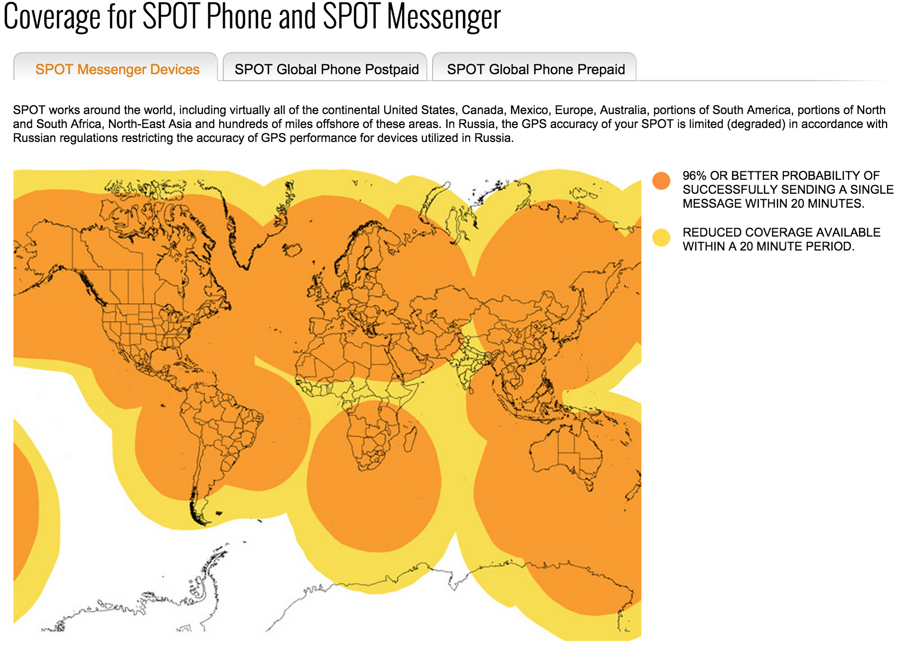
SPOT satellite coverage map
The SPOT map covers the majority of the world, but gaps do exist if you’re going to parts of Africa or Asia.
Bottom Line
Both devices work very well, but these factors differentiate them. For the occasional adventurer who only needs satellite coverage for a couple big trips a year, and checks in now and then with friends & family, the DeLorme inReach is the best value. Exceptions exist if you’re an outdoor guide and need coverage for all 12-months of the year, but that isn’t a typical user. The DeLorme is slightly less portable than the SPOT, but the benefit of two-way text communication really puts the DeLorme inReach above the SPOT Gen3. Additionally, the online user interface for the DeLorme is a bit smoother than that of the SPOT. Finally, don’t fall for the monthly payment option on the SPOT. Avoid concentrating on the upfront cost of the device, and think carefully about your future usage to determine which device will give you the best value and function for your money in the long run.
Best prices on the inReach & SPOT (as of September, 2016)
SPOT GEN3
REI: $149.95
Amazon: $149.95
Backcountry.com: $169.99
DeLorme inReach SE
REI: $299.95
Amazon: $264.98
Backcountry.com: $299.95
Any questions or opinions? I'd love to hear from you, just leave a comment below.
Like this post? Sign up below for an email newsletter from the site. No spam, I promise!
Looking for more to read? Here are some recent articles from the site:


My last two trips down the Canyon were 20+ day self support solo kayak trips and I was ready to share the experience with someone else. The only catch was I only had 8 days off of work, so it'd have to be a quick trip. And in the spirit of adventure it made sense to go all the way to Pearce. It wasn't an easy sell - paddle 40 miles per day, for 7 days, in the middle of winter, but a good friend from college agreed to come along and I was stoked for the adventure.